riverscape

The morning of March 22 dawned clear and bright according to Prince Maximilian, who noted in his journal that the river had risen three inches since the previous midnight. The steamer approached the Chester Islands around nine o'clock "in about six feet of water" and the mouth of St. Mary's River, on the right, flowing into the Mississippi from between densely wooded banks.

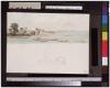
Fire Island on the Mississippi

Judging from dated inscriptions on various extant studies, Bodmer seems to have stayed in the New Orleans area approximately ten days. Maximilian's subsequent account indicates "about eight days" and states that the artist embarked on the steamer Arkansas for Baton Rouge on January 22. This view of the lower Mississippi, dated January 21, is presumed to have been made at or near New Orleans. It depicts types of craft then in use on the river. What appears to be the head of an Indian is faintly outlined at left center

Scene on the Mississippi

As the Homer descended the river below Natchez, Fort Adams appeared ahead on the left bank. Maximilian related in his subsequent account of Bodmer's voyage that Fort Adams was a place of about twenty houses, adding that "the real fort doesn't exist any more." Bodmer made two studies in this vicinity that include few details of the abandoned military installation but describe its setting in general terms. His rendering of a "distant view" of Fort Adams was made on January 9 or 10.

Distant View of Fort Adams

Bodmer made several sketches of the mouth of the Arkansas River in passing downstream toward Natchez. Today this aspect of the river is greatly altered, and a modern ship channel and system of locks carries Mississippi barge traffic on the Arkansas to just below Tulsa, Oklahoma

Mouth of the Arkansas

A restless and meandering river, the Mississippi has changed its course many times in the years since Bodmer traveled it. Along its winding channel are numerous old bends that at one time were part of the main course of the river but are now cut off from it. Thus it is difficult to place some of Bodmer's views of the Mississippi without the aid of a dated inscription or other identification.

View on the Mississippi

Today the city of Cairo, Illinois, stands at the junction of the Ohio and Mississippi rivers near the site where Fort Defiance once commanded a view of the surrounding wilderness. In Bodmer's day a small settlement existed at the mouth of the Ohio, as evidenced in this sketch made in the early part of 1833.

Mouth of the Ohio: Store and Tavern on Tip of Land

Below Paducah, Kentucky, Bodmer sketched a view of the Ohio near the site formerly occupied by Fort Massac. Only a few scattered stones marked the spot when Bodmer saw it. Passing this same area in March 1833 Maximilian noted in his journal that the steamer stopped here at a small settlement to take on wood.

FortMassac on the Ohio

When Bodmer passed by Smithland in January, 1833, he noted that large areas of the adjoining forest had already been cleared for agriculture. About three miles below Smithland on the left bank of the Ohio stood the remains of the original settlement; this had been abandoned in favor of the site at the mouth of the Cumberland, which was more elevated and less subject to flooding

Smithland on the Ohio

Representing the natural landscape near New Harmony allowed Bodmer a freedom of artistic expression not easily realized within the formal constraints of scientific illustration, portraiture, or architectural description. This view of the Cutoff River, a tributary of the Wabash, probably made in late November or early December of 1832, was later featured as Vignette VIII in the atlas of aquatints published in Europe.

The Cutoff River, Branch of the Wabash

Following an excursion along the Fox River, Maximilian described its waters as "clear and dark green, the visible ground at the bottom completely covered with shells." He also remarked upon the beauty of the surrounding forest in which "tall, widely ramified, colossal Platanus trees were shining snow white in the densely entangled thicket." Bodmer produced several finished watercolors of the wilderness landscape near New Harmony which include aspects of the scene described by Maximilian.

The Fox River near New Harmony

Pages