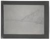
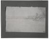
Identified as a distant view of the Indian agency at Bellevue, this sketch is dated May 2, but was probably made around noon on May 3 as the Yellow Stone made its way above the mouth of the Platte toward Dougherty's post.
A Distant View of Bellevue
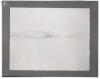
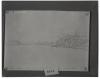
Identified as a distant view of the Indian agency at Bellevue, this sketch is dated May 2, but was probably made around noon on May 3 as the Yellow Stone made its way above the mouth of the Platte toward Dougherty's post.
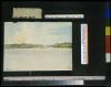
The morning of April 23 dawned bright and fair, and Bodmer made this sketch of the Missouri River above Fort Leavenworth. Early in the afternoon the steamer reached the mouth of the Independence River. Maximilian wrote in his journal that "the forest was very green here.... To the left from lovely forested banks the Independence River opened up in a highly picturesque fashion into the Missouri."
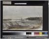
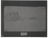
This undated view of the Missouri is believed to have been made by Bodmer near Fort Leavenworth where the Yellow Stone stopped to take on wood on the afternoon of April 22. Maximilian described Leavenworth as "built for four companies of regular military who are altogether only 120 men strong.... In order to reinforce them, 100 more rangers have been added ... who in emergencies must make raids against the Indians."
On the afternoon of April 18, the Yellow Stone encountered a stretch of water so densely packed with snags that it could proceed no further under its own power. Maximilian recorded in his journal for this day, "Again we lay still for a long time, fathomed and cut off dangerous trees, then 26 men were put on a sandbank on the left to pull the steamboat." At around two o'clock the,steamer was under way, but again ran aground in less than half an hour on a large sandbank. Here it remained overnight.
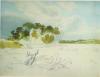
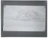
Past Tavern Rock on the Missouri on April 12, the Yellow Stone encountered low water and had to be pushed along by poles. At noon a stop was made to take on wood. Bodmer meanwhile continued to make studies of the river. Maximilian spent much of the afternoon engaged in discussions with Major Dougherty relating to the current state of Indian affairs and activities on the upper Missouri. This sketch of the Missouri River above St. Charles is dated April 12.
The steamer continued upriver past Herculaneum on the afternoon of March 23. Maximilian noted in his journal that above Herculaneum Bodmer made a quick sketch of an island in the river. That afternoon, beyond the mouth of Pear Creek, the passengers glimpsed Jefferson Barracks, where the celebrated leader of the recent Black Hawk War was being held prisoner by the U.S. government. In the evening the steamer tied up near the old settlement of Cahokia on the Illinois side of the river opposite St. Louis.
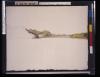
Bodmer made a sketch of Shot Tower Rock below the settlement of Herculaneum at about noon on March 23. Maximilian observed, "Here in a leveled-off inlet the small village Herculaneum lies, with small grey wooden houses, of which some have been painted white.... By the miserable huts one can see some elegant ladies moving on the beach, their veils fluttering most romantically in the wind! On the limestone hills to the left stands a shot tower on the edge of the rock (see Mr. Bodmer's sketch)."
Around noon of March 22, the steamer passed the mouth of the Kaskaskia River below the site of the old French trading settlement of that name situated on the Illinois side of the river. That afternoon it reached the village of Ste. Genevieve. Maximilian described the approach to this village in his journal, commenting, "In front to the right, the river, because of its bend, seems to go through a narrow opening (see Mr. Bodmer's sketch)....The steamboat Arg’äεs overtook us near Ste. Genevieve.... It passed us and we landed."
At Mount Vernon the travelers embarked on an Ohio steamer on the morning of March 18. The ensuing voyage downriver was rapid. Maximilian reported the sighting of Devil's Island on the Mississippi above the mouth of the Ohio near Cape Girardeau, Missouri, late on March 20 and again the following day. "Devil's Island," he wrote, "undoubtedly is Elk Island of the Western Pilot, for these islands are often given different names."
Above Cape Girardeau, Missouri, near Hanging Dog Island on the morning of March 2 1, Maximilian observed, "This region of the river is called Hanging Dog Bend. The river is beautiful and wide. On the left tobacco is grown. Farther away is the mouth of Indian Creek, now called Apple creek." Bodmer made two quick sketches in this vicinity.
 |
 |