Ohio River

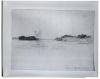
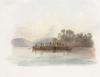
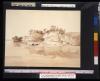
Maximilian described the area near the mouth of the Ohio in March as "a monotonous land with high forest." He noted the presence of numerous snags in the water and in commenting upon the difficulties of river travel observed that "here one may navigate by daylight only, as the water level is too low."

Confluence of the Ohio and Mississippi

Today the city of Cairo, Illinois, stands at the junction of the Ohio and Mississippi rivers near the site where Fort Defiance once commanded a view of the surrounding wilderness. In Bodmer's day a small settlement existed at the mouth of the Ohio, as evidenced in this sketch made in the early part of 1833.

Mouth of the Ohio: Store and Tavern on Tip of Land

Bodmer made several drawings at the confluence of the Ohio with the Mississippi on one or another of his voyages downriver from New Harmony. This sketch may have been done when he first descended the Ohio en route to New Orleans in January 1833, or when he followed the same route with Maximilian two months later.

Mouth of the Ohio

Below Paducah, Kentucky, Bodmer sketched a view of the Ohio near the site formerly occupied by Fort Massac. Only a few scattered stones marked the spot when Bodmer saw it. Passing this same area in March 1833 Maximilian noted in his journal that the steamer stopped here at a small settlement to take on wood.

FortMassac on the Ohio

When Bodmer passed by Smithland in January, 1833, he noted that large areas of the adjoining forest had already been cleared for agriculture. About three miles below Smithland on the left bank of the Ohio stood the remains of the original settlement; this had been abandoned in favor of the site at the mouth of the Cumberland, which was more elevated and less subject to flooding

Smithland on the Ohio

Approximately twenty-five miles below Cave-In-Rock lay Golconda Island, and beyond it the settlement of Smithland at the mouth of the Cumberland River. Passing by in March, 1833, Maximilian described the Cumberland as smaller than the Wabash and Smithland itself as similar to the small Brazilian villages he had seen on his travels in South America more than ten years before. Bodmer's sketch of an Ohio steamer, identified by its inscription as having been observed near Smithland, appears to have served as the model for the riverboat illustrated in Vignette VII of the aquatint series.

The Ohio near Smithland

A few miles below Mount Vernon stood the village of Shawnee Town. Maximilian described it as "a dead, sad place" when he traveled this section of the Ohio en route to St. Louis in March, 1833 . About twenty-five miles beyond lay an unusual geological feature known as Cave-In-Rock on the Illinois side of the river near Cave-In-Rock Island, today within a state park.

Cave-In-Rock on the Ohio

Bodmer sketched various types of vessels on the Ohio and Mississippi rivers during his voyage to New Orleans in January, 1833. His detailed small study of a keelboat on the Ohio depicts one of the more common craft used at that time for transporting river cargo. Keelboats, flatboats, sailboats, and canoes were in use on the Ohio, Mississippi, and Missouri rivers throughout the first half of the nineteenth century.

Ohio-Mississippi River Keelboat

Dated November 21 1832, is this sketch of the banks on Saline Creek, a tributary of the Ohio. Maximilian recorded on this day that Bodmer made drawings "at home," later went walking in the woods, and in the afternoon paid a visit to a local whiskey factory to view its steam engine. Maximilian's journal makes no further mention of Bodmer's activities at this time, but it may be supposed that he made the sketch during an afternoon stroll along Saline Creek.

Saline Creek

On the morning of October 18 the Water Witch weighed anchor and continued downriver. In his journal Maximilian wrote that "in spite of the low water level, the Ohio is very wide and beautiful." Bodmer's sketch of the rocky shoreline in the vicinity of Rockport, Indiana, was made before breakfast this same morning and serves to illustrate the descriptions in Maximilian's journal of unusual rock formations observed along the Ohio.

Rockport on the Ohio

Pages