Missouri River

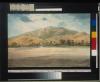
On the morning of July 6 Maximilian's company departed upriver from Fort Union for Fort McKenzie on the Flora, a sixty-foot keelboat captained by David Mitchell, company manager for Fort McKenzie. Fifty-two passengers embarked including Maximilian, Bodmer, Dreidoppel, Mitchell, and Mitchell's Indian wife, one of two women on board. In his journal Maximilian subsequently mentioned a number of sketches made by Bodmer during the course of this voyage.

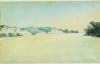
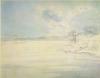
Rock Formations on the Upper Missouri

Shallow water delayed the steamer's progress on May 14 above the mouth of the Niobrara. When the Yellow Stone ran aground on a submerged sandbank, several of its passengers went ashore to stretch their legs and explore the banks. While Bodmer made another of his Missouri River landscapes at this place, Maximilian caught a softshelled turtle and collected a specimen of wild turnip to add to his North American collection

Missouri River landscape

Having gone aground on another sandbank on the afternoon of Mays, the Yellow Stone was again moving upstream on the following morning. On the morning of May 7 it passed within sight of the Blackbird Hills, named for a prominent chief of the Omahas whose grave was located there. According to local legend, the chief had, by his own instructions, been buried in a mound seated upright on a live mule. Bodmer made a watercolor study of the river in this vicinity later reproduced as Vignette XII in the aquatint atlas.

View on the Missouri, Blackbird's Grave

On July 9 above the mouth of Martha's River, Bodmer produced a watercolor identified by Maximilian as sketch F in his journal entry for this day. His description of the river at this point corresponds to both sketch E, reproduced at the bottom of the previous plate, and sketch F, appearing here as the uppermost of two views on the same sheet. The lower rendering may represent a view from the opposite bank of the Missouri mentioned in Maximilian's journal as sketch G. However, there is more than one view in this series, so precise identification is uncertain.

Unusual Elevations on the Upper Missouri

On July 26 Maximilian again commented in his journal that along the left bank of the river he observed "the formation mentioned yesterday, which is similar to the mountain castles that we called today the White Castles. Although a closer look takes away something of the resemblance, we can still regard this strange mountain top as masonry." The formation lies in an area of the Missouri River basin now inundated by the waters above Fort Peck Dam in eastern Montana.

The White Castles

The Flora encountered low water, swift currents, rain, and clouds of mosquitoes during the first ten days out from Fort Union. On July 17, near the place where another keelboat had been wrecked in a storm the previous summer, passengers observed a large beaver lodge. Bodmer made a study on this date which formed the basis for the later aquatint designated as Vignette XVII in the atlas published in Europe.

Beaver Lodge on the Missouri

Maximilian mentioned in his journal entry for May 15 that the Yellow Stone lay still until around four o'clock in the afternoon while its crew endeavored to shift it off a sandbank along the western side of the river channel. Strong winds and contrary currents complicated this procedure, and at one point the Yellow Stone was rolling so badly that, according to Maximilian, Bodmer could scarcely draw.

Banks of the Missouri

Bodmer made several studies in the general vicinity of the Niobrara. This watercolor dated May, 1833 may be one of these, but the precise location of the view is not known. Because of modern water impoundments above and below the mouth of the Niobrara, the original aspect of the Missouri throughout this area has greatly changed since Bodmer's day. Thus identifying landmarks noted by Bodmer is virtually impossible.

Missouri River landscape

Another of Bodmer's views of the Missouri, dated May 3, describes an aspect of the river four or five miles below the mouth of the Platte. In his daily account Maximilian noted that at this point one could already distinguish the effluent of the Platte "since it is clear and blue; it runs separately along the bank lying to the left of us."

The Missouri below the Mouth of the Platte

The Yellow Stone spent the night of April 28 near Good Sun Island above the mouth of the Nemaha. Then, slowed by low water and another grounding, it made no further progress upstream until May 2. After supper that evening a canoe came alongside the steamer. Aboard was Lucien Fontenelle, described by Maximilian as "in the service of the Fur Company. He lives on the post where Major Dougherty owns a house when he travels among the nations of the Otos, Omahas, and Pawnees as Indian agent." The Yellow Stone tied up for the night a short distance below the mouth of the Platte.

The Missouri in the Evening

Pages