March 19, 1833
19 March: On the morning of the 19th: At daybreak the pleasant, friendly innkeeper wakened us to announce that two steamboats were coming down the Ohio. We jumped out of bed, quickly got ready, and had the inn's blacks take our baggage to the steamboat docked above. It was the Paragon, not large but said to be fast. A much larger ship, the Brunswick, had been here for three hours but had just departed. The river now bore four steamboats upstream. Its broad surface glimmered beautifully; the sky was overcast, the morning pleasantly warm.
We boarded the Paragon and found Dreidoppel on board with the baggage. The captain—his name was Estes (pronounced “Istis”)—a friendly, agreeable man, had established a farm near Prairie du Chien, up on the Mississippi on the Muskingum, about a year ago. The Menominees and Winnebagoes, with whom he is on very friendly terms, live close by. He sails his steamboat back and forth. In the Black Hawk War, he fought against the Indians and exchanged shots with them. He is well acquainted with them and provided me with some interesting information. According to him, the Winnebagoes build long lodges with rounded tops and are large, handsome people. The Menominees are not so tall but very well built, about 5' 8 ", and have handsome, round faces.
The total length of our ship was about 51 of my paces. It had sixteen beds in the men's cabin. Families lived above on the second deck.
We departed early [and] admired the broad surface of the majestic Ohio, which is significantly wider than the Rhine. The enormous tall woodlands along its banks looked as though [the trees were] sheared off on top with a scissors. In the woods, Platanus, with snow-white branches. The first island was a small one, beyond which we passed through a narrow channel. A wildly eroded willow-island. Alcedo alcyon abundant everywhere. Anas boschas and rufitorques flew up.
We now approached the most beautiful section of the Ohio, where it has higher, rocky banks. High hills. In the widespread forest there were picturesque areas of limestone. After breakfast we saw very high, wooded hills. To the left, low wooded banks, picturesque valleys. On several hills, broken yellow limestone lay irregularly. River water light yellowish brown or yellowish-reddish, somewhat like the Rhine, very agitated by the rapid course of the Paragon. Beautiful gradations of the hills with their woodlands, dark brown interspersed with white Platanus, here and there green stripes of cane (Miegia) underneath. The Saline River to the left.
Farther down in Illinois, a long, flat layer of rocks below along the bank, 60 to 80 feet high with many horizontal strata, covered with whitish green, bluish green, and bright green lichens. Individual gorges and clefts in them; a hut and woods on top. This is Battery Rock, an odd, long rock located along the base of the bank, which Mr. Bodmer would have liked to sketch. Then came large blocks of limestone along the bank, interspersed with white Platanus.
Flatboats float by. Dogs sit on the deck and look about. The buds already lend the Platanus a reddish brown tinge on top. To the right behind the high wooded bank, several open spots, very picturesque, behind which are mountains with boulders and turkey buzzards sitting on them or hovering in the air. White ducks streak past as swiftly as an arrow. Cottonwoods often form long rows along the wooded bank. The weather is good; the sun emerges. At seven thirty, 8°R [50°F, 10°C]. Individual gulls.
To the left, rocky ground on which grow cedar trees (Juniperus virginiana) 20 to 30 feet high, next to which there is a cleared tract with a nice house surrounded by fields and fences. Before us a beautiful view into the distance, where a steamboat gives off smoke. I sat on the stern gallery of the ship next to [a] hanging piece of meat and wrote with The Ohio Pilot of 1829 in hand. The Americans, in their great indolence, stared in astonishment at my activity. To the left, a pretty creek near an eroded spot by a hill, where several dwellings and green fields provide a pleasing contrast.
[Page 1:207]
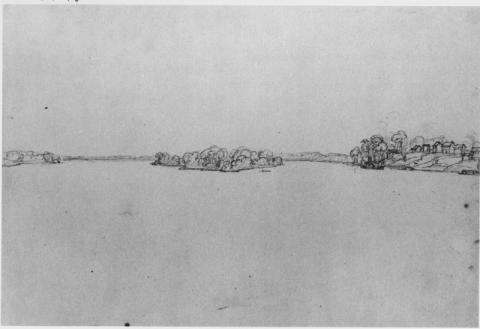
We reached Cave-in-Rock Island, a long, oval island. It remains to our left with its tall forest. The tip of it [is] sandy, with willow thickets. On the opposite side to the right, limestone ledges begin up along the hills, [with] evergreen cedar thickets on top. Wildly broken timber on these rocks. Remarkable steep precipice; everything overgrown with coniferous woods; above it tall, broadleaf forest. Regular, narrow layers of yellowish, often bluish, ash-gray, or reddish limestone rocks, also yellowish red clefts and gorges in which is found Cave-in-Rock, a roundish opening that completely penetrates the rock. Cave-in-Rock [is] directly opposite the  end of Cave-in-Rock Island, 25 miles from Shawneetown. Numerous limestone petrifications and impressions. Immediately behind them, an open area and a settlement. On the rock grow coniferous trees, here called cedar, in large number.

Before the ship, Hurricane Island appears, to the right of [it] lies Tower Rock. In the channel to the left, the smoke of a steamboat winds and twists in the air. From now on, gentler, frequently undulating banks. The tips of some hills sliced off vertically. Limestone rocks. Here and there cultivated fields where the forest has been somewhat cleared.[Page 1:208] Some parts of the banks [are] steeply washed away, [leaving the] tall Platanus undercut and ready to topple. Wherever one sees only steep rock walls, nothing but green cedar grows there, and only at these spots. In many places, huge heaps of cordwood [are] piled up for the steamboats.
The Ohio Pilot [The Western Pilot map] no. 18 directs steamboats to the right, past Hurricane Island; we turned left and hence did not see Tower Rock so well. This is one of the previously mentioned cliffs to the right across from the island (Hurricane Island). Before the island itself there is a flat, roundish expanse, a sandy island overgrown with willows. The sand along the bank has been deposited in layers, or rather in rings, by the water. Then comes a narrow channel and then Hurricane Island itself: long, rounded in front, with tall forest, slender cottonwoods along the bank [and] trees behind [them] wildly entangled by vines. Broken-off trees, lying pell-mell, present a picture of the river's devastation. A part of the island has green cane on the floor of the forest—here, it seems, not gnawed to bits by the cattle.
On the bank of the mainland to the left, three strata appear: clay above and below and sand in the middle. The island is very long. It takes at least half an hour to sail past it. Before it comes to an end, the willows begin again and, before the tall forest, form a yellowish-reddish gradation and a point like the one at the beginning. To the right, directly behind the island, a creek, unnamed in the book.
On the river a man in his boat waved his hat vehemently. The engine stopped; the red-haired passenger was taken on board. To the right, rugged hills with rocky debris and individual trees; here eight flatboats lay to or sailed along the bank. Wherever there is limestone, one at once sees single cedars. The strata are often noteworthy, the hills mostly gently conical; in the case of some, the top is stratified like a cap.
 One steamboat always sails ahead of us; its white smoke contrasts nicely with the blue, violet-blue, or brown elevations, depending on how near or far away they are. Here several stretches of the Ohio are very wide. To the left, a wooded hill with huge boulders covered with a vividly green moss, and the high cliffs above covered with whitish lichens. Several miles farther to the right, a high limestone precipice, all stratified with diagonal crevices; then a creek. Opposite, on an 80-foot-high cliff, an oxcart halts [and] cordwood is tossed down. Down below there is a high pile of wood. At eleven o’ clock a Negro rang for luncheon, consisting of crackers, cheese, ham, raisins, and almonds, with which people drank cider.
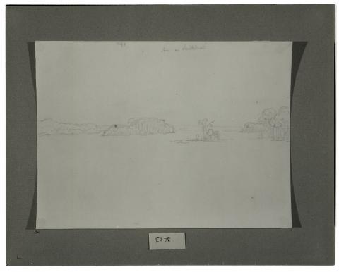
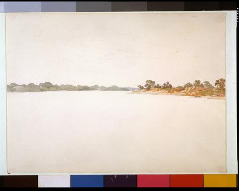
We reached Golconda Island, rather elliptical with tall forest and several cultivated fields. It is 20 1/2 miles distant from Cave-in-Rock. Golconda soon appears behind the island to the right, in an inlet behind lofty wooded hills where Lusk Creek empties. This town is the seat of the judicial courts of Pope County, Illinois. Apparently a small town; several buildings painted white. A new courthouse is being built; the tower is just being placed on it. It has exactly the same architectural style as the one in Mount Vernon: rectangular, three windows on each side.
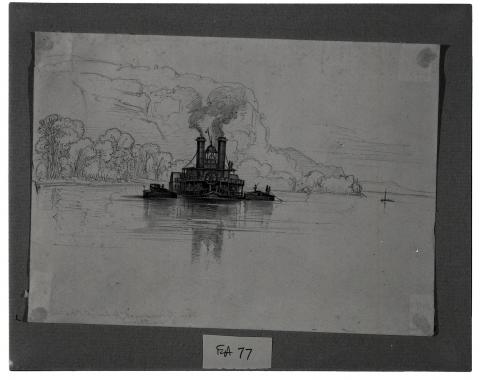
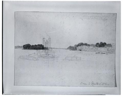
Next come the Sister Islands. We reach the first one, which is covered with forest, in the middle of the river. Cottonwoods and willows on the bank. We caught up with the steamboat New Brunswick, a large New Orleans boat, which towed the two horse boats (fastened to its sides) from Mount Vernon. Splendid view of the ship! All the people, black and white, gather to watch [our ship,] the Paragon, pass (see Mr. Bodmer's sketch, drawn near the second Sister Island). We leave that steamboat far behind. The two Sister Islands are located beside each other, eroded, with tall forest and willows; the low sandbanks [are] stratified.
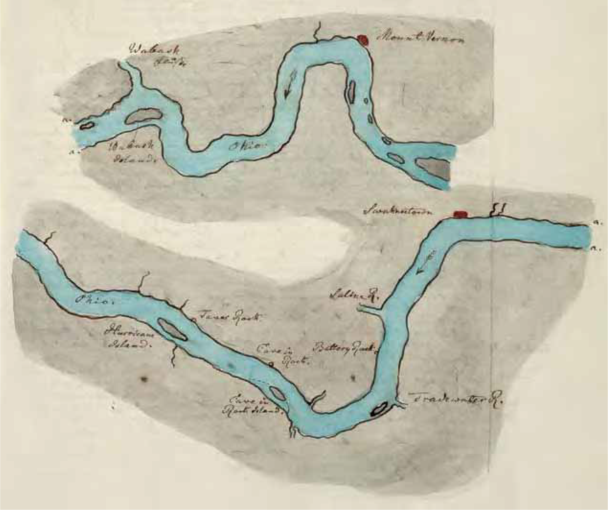
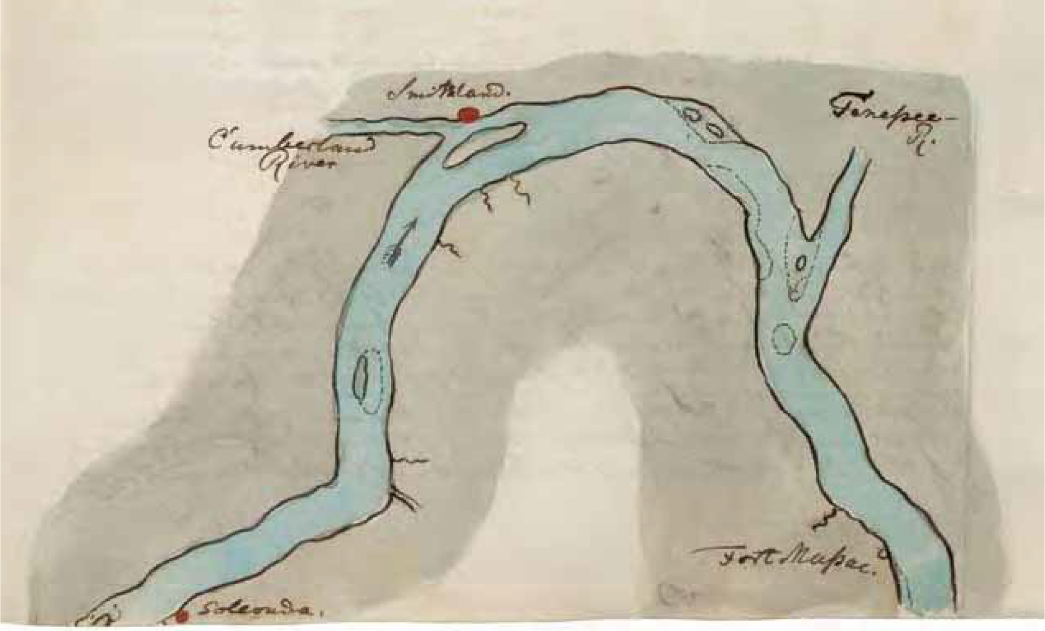
Now the Ohio is very broad and splendid. The view to the rear reveals four islands and the steamboat New Brunswick. At noon, warm sunshine, 12°R [59°F, 15°C]. To the right, along the hill, large areas where trees are felled; to the left, cane in the forest. Next comes Stewart Island, 50 miles from Mount Vernon, with tall, slender forest trees. Four miles to Dog Island. Soon Cumberland Island appears, and to the left opposite it, the mouth of the Cumberland River. Before that, a creek. [The] Cumberland River enters the Ohio at a very acute angle. It has a weaker current than the Wabash. On the point of land between it and the Ohio, several houses. Opposite its mouth, the market town Smithland, like a little Brazilian villa with small, low, one-story houses.
[Page 1:209]
We stopped here for a half hour; the Brunswick followed our example but also took on some wood. Chickens from this ship ran into the town and prompted a chase. Blacks brought chickens, vegetables, etc. On its low banks, Cumberland Island has parallel channels cut into the sand. Near Smithland a significant amount of land has been cleared for farming. The Ohio agitated by a brisk, contrary wind. On the left bank, about 2 to 3 miles down from Smithland, stood the old town of this name, which no longer exists because the ground it was located on was too low. It was transferred to the mouth of the Cumberland, on which Nashville is located farther upstream.
The Ohio, very broad and imposing, becomes narrower upstream; on the large island in the middle, a clearing has been cut in the forest. To the left, picturesquely wild forest scenes; hills in the tall timber on which there are small white log houses (unpainted but made from new lumber). Everywhere along the bank, thick, broken-down tree trunks, some of them burned. Urubus hover about overhead. Farther on, fringes of cottonwoods along the bank; in the forest to the right, sometimes cane underneath. Farther on, a fringe of tall, slender cottonwoods. We closely approach the bank to the left; there in the forest, one notices tall, dry plants of the Syngenesia. The Tennessee River discharges to the left behind a wooded sandspit.
On the river to the left, there was a magnificent ray of light, which greatly enhanced the landscape. On the opposite side is an island. Along the right bank, cane grows in the forest. The Tennessee is more important than the Cumberland; its course is 1,200 miles in length. Immediately behind the last island, on the left bank, is the town of Paducah, where the steamboat Samson lay at anchor. We stopped to discharge passengers. This town has developed only recently, for The Western Pilot of 1829 does not mention it. Several miles from here, nice view upstream; the steam from the Brunswick rose in the distance. To the right, a steep cutbank, 15 to 20 feet high. Farther on, to the right, yellow sand above with a green area of grass where Fort Massac was located on a small open space before the forest; of the fort, nothing is now to be seen except stones. Now there are two solitary planters’ homes here, near which an opening has been hewed into the forest. The inhabitants stood near one of these two-story houses and watched us sail by.
Several hundred paces farther on, we stopped near another clearing with several dwellings and took on wood. It is measured, and the deck passengers carry it on deck, where it is piled up beside the steam engine. Our ship needs eight cords of wood daily, if [the wood] is good and dry. M5A cord of wood is 128 cubic feet: 8 feet long, 4 feet high, and 4 feet wide.
On land the grass is now becoming a beautiful, fresh green; large, long-legged sheep were grazing on it. The numerous puddles here were full of the small tree frogs I mentioned near Mount Vernon, and their chirring immediately ceased as soon as we approached. We could not catch any of them.
Mr. Bodmer immediately ran into the forest with the shotgun; [he] shot nothing but fell into the swamp. There was a pitiful hut here. Its inhabitants, a bunch of dirty children, were all together. Two boys were riding on one horse, as often happens here. In the evening, uniform land overgrown with tall forest. We lay to at the bank for the night.