Unusual Elevations on the Upper Missouri
Description
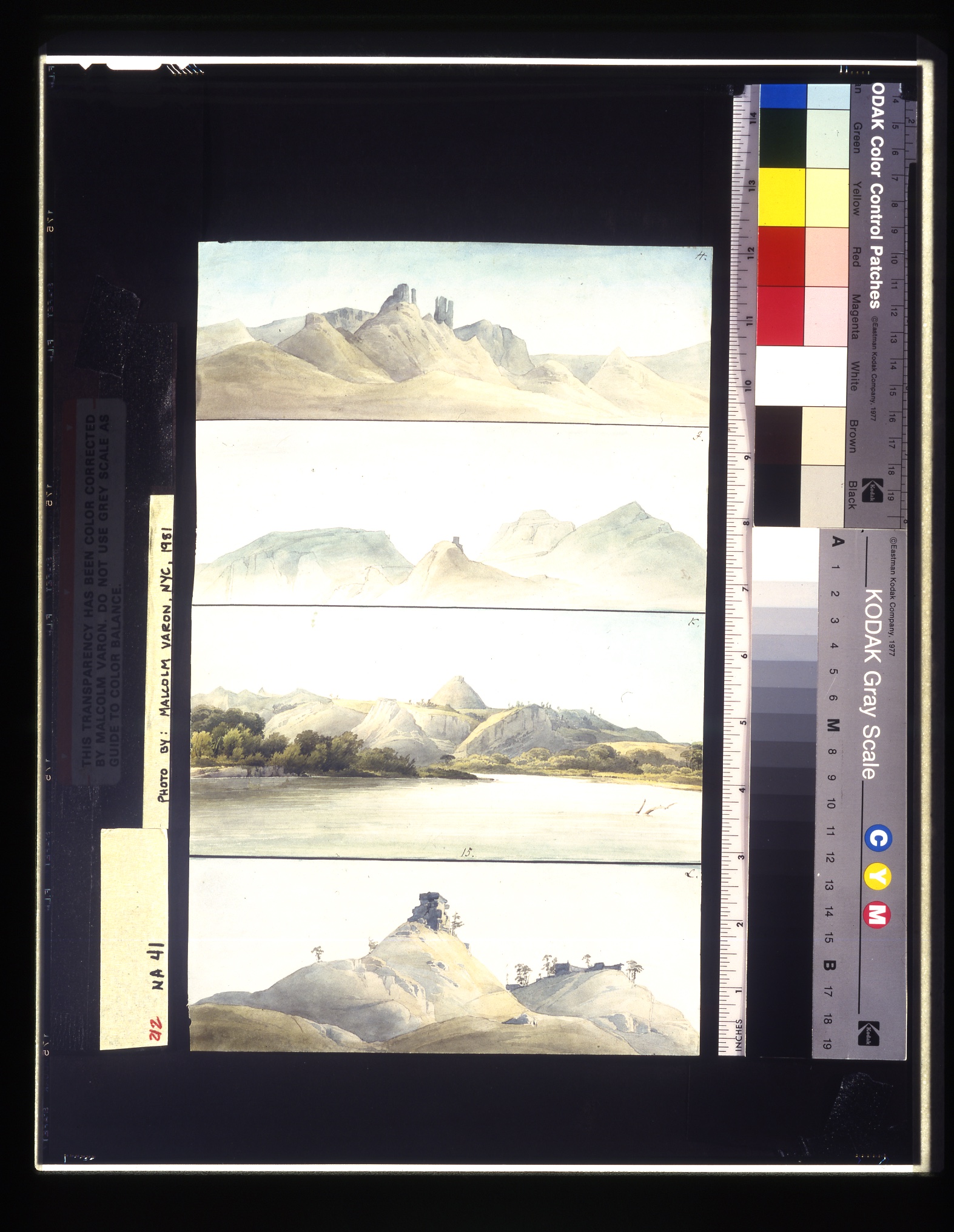
Aided by favorable winds, the Flora progressed a considerable distance upstream above the mouth of the Milk River on July 22. Herds of elk appeared along the bluffs above the river and Dreidoppel killed a buffalo. Maximilian noted in his journal for this day that Bodmer made a sketch of clay peaks "resembling the ruin of a mountain castle on the Rhine." This is sketch H in the plate. On July 24 Maximilian again mentioned that Bodmer made other sketches designated by the letters I, K, and L near Slick Lodge Creek, including the representation of a peak on the left bank of the river supposed to stand halfway between the Milk and Musselshell rivers. Executed as four horizontal views on a single sheet of paper, the sketches thus identified describe an area of the Missouri basin now inundated by the waters of Fort Peck Reservoir, the fourth largest impoundment of its kind in the world.
Original German Title
None
Medium
watercolor over pencil on paper
Dimensions
12 1/8 x 7 5/8
Call No.
JAM.1986.49.185
Approximate Date of Creation
22nd July 1833

