Snags on the Missouri
Description
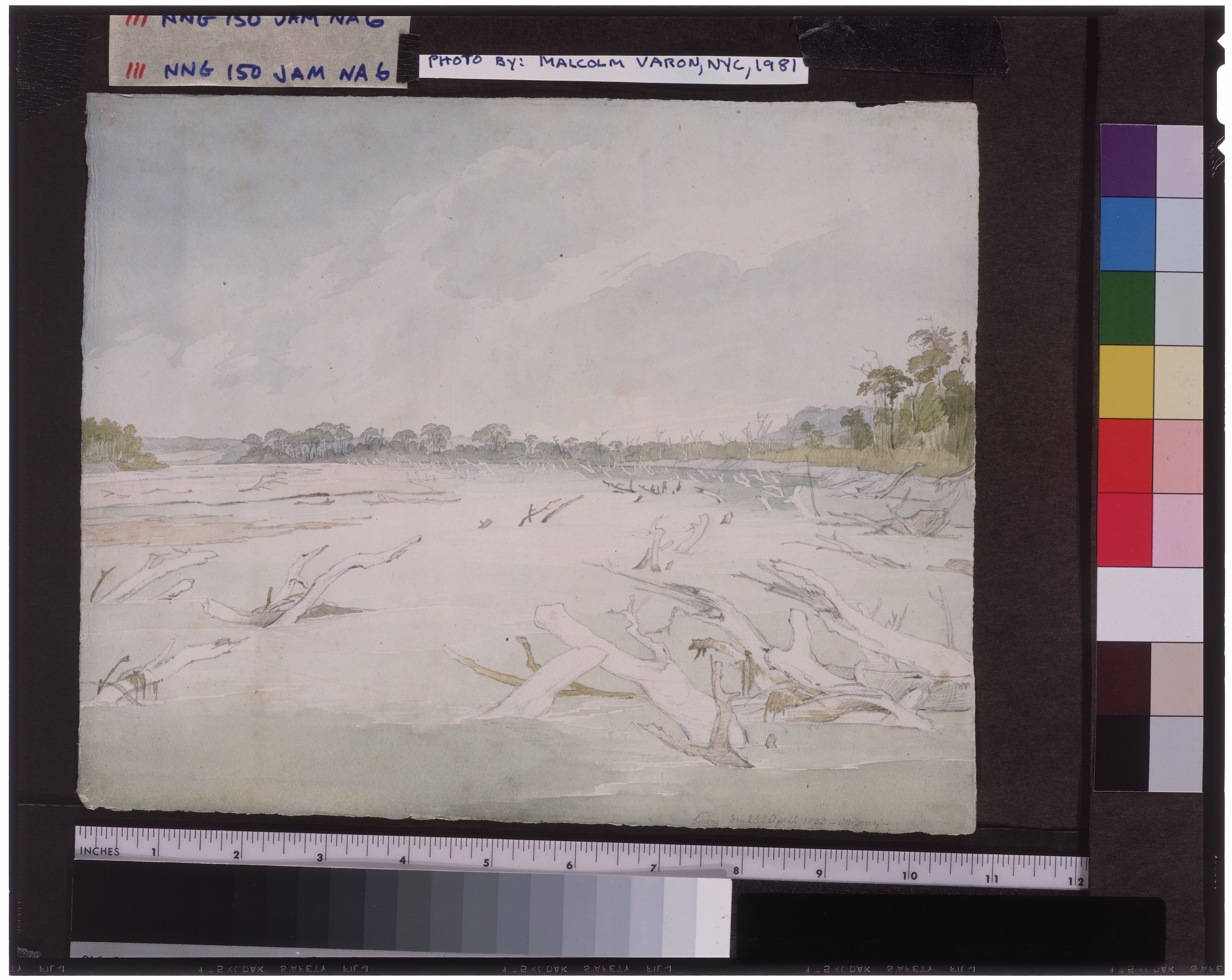
Navigating between the rafts of driftwood on the Missouri became increasingly difficult as the Yellow Stone plied upriver toward the mouth of the Platte. On April 26 it passed the mouth of the Nemaha River, or "Grand Nemaha" as Maximilian calls it, and again encountered snags and sandbanks. Maximilian wrote in his journal on this date, "For a long time we could not get away from this spot here and often ran aground (behind an island here the Tarkio River discharges) but finally with a little force of the engine we moved on." Dated this same day is a watercolor sketch of the Missouri in which Bodmer delineated the encumbering snags in the immediate foreground. This view formed the basis for the aquatint later designated as Tableau 6 in the atlas of plates published in Europe.
Original German Title
None
Medium
watercolor and pencil on paper
Dimensions
8 3/4 x 10 3/4
Call No.
JAM.1986.49.150
Approximate Date of Creation
26th April 1833

